Today I went back to SF Park after having checked the "How it works" link I found there a few weeks ago. The parking situation is being documented now and while the results are imperfect I want to say that this is a positive development.
However, it isn't with out its critics. When SF Park was originally developed there were a series of articles in the SF Chronicle (S.F. releases details..) which described how the plan was going to be unveiled. Reading the comments for many of these I was able to get a good idea of how the more vociferous felt.
Many of the comments are obviously without merit, such as the goofy one from "Emperor Norton" himself and at least four comments attacking the ideological commitments of local politicians. Likewise those opposed to the "flexible parking" as some like to call the idea behind SFPark made a number of comments that were simply untrue. However, there were other comments that said things about bicyclists and cops which seemed on point but would have been better placed elsewhere since SFPark is about cars and enforcement is not a police matter.
The the largest number of comments concerned bureaucratic bungling, the dishonesty of Nathanial Ford and the bloated payrolls of public officials which requires a more thorough review than the above described comments. This is primarily because many viewers seem to believe that San Francisco's parking problem is linked to corruption in government. While I am not necessarily going to contest this viewpoint, I am wondering whether these types of comments really belong in an article which is basically meant to review the steps that the city is going through to implement a new and innovative parking policy.
After reading through the majority of comments, I was startled at two things. There were relatively few comments that really dealt with questions and concerns for the project and even fewer which actually supported it. However out of the few positive comments that I was able to find there were some readers who went out of the way to support the project. For instance, some took the time to read comments and explain that issues of MTA administration and bloated payrolls were issues that had to be dealt with in parallel with the implementation of SFPark. Others pointed out that making Muni more effective should be a part of the plan. Mostly what people said was that parking is a problem already in San Francisco and implementing anything at all would be a change for the better.
Other comments critical of SFPark were not as positive. For instance many were really concerned that this project would effectively be a tax on driving with many accusing the city of price gouging. Others attacked the empirical/ theoretical basis for the plan indicating that the project was simply too car-centric. One of the more noticeable comments concerned those who would choose to "game the system" with multiple comments indicating that handicap placards would multiply and their use would tax the city's already overburdened staff.
Many indicated that they had very little interest in visiting a city that would charge them exorbitantly for parking. They said that this program was unfair to people that had no other means of transportation, couldn't bike to work or didn't have the kind of money necessary to pay. Some of the bleakest assessments believed that this would only make traffic more terrible. Above all the consensus was that it was inevitable that the cost of parking in the city was going to rise.
In contrast, there were several comments which were hard to identify as being positive or negative. For instance, several comments indicated that they were certain that they would no longer drive in the city or to those districts which were affected by the new program, an outcome which is what the system was designed to create. Many also pointed out that while scanners may be monitoring our activities and placards may be a way to game the system, we already are being monitored innocuously via the internet and placards have been the subject of gaming for quite a while. Also, there were several comments which indicated that the parking problem is bad in everywhere and that every county needs to buy new meters and develop a system which addresses the problems in our urban areas.
I was especially surprised to find that very few asked questions about how the program was actually going to be rolled out. For instance one person asked, "Do the rates change while your car is parked?" This was something that I figure will be resolved as the program progresses- if i hasn't been dealt with already. Another asked what the alternative to this program, a question to which, unsurprisingly, no one had an answer. Finally, I felt that the most pressing question was, "How do people know the rate?" This is a major matter of contention since a number of people pointed out that drivers may be tempted to use the internet while driving or may be inconvenienced by the discovery that parking can at times be especially expensive.
Sabtu, 23 April 2011
Minggu, 17 April 2011
Funny thing happened today at Mojo...

Golly. Sometimes things just take you back.
While reading the paper as I always do on Sunday at Mojo I happened to strike up a conversation with the person next to me. I mentioned the Sierra Nevada and was asked, "How is the Sierra?"
It was quite a long time later that I realized not only had I sold this person on the place but that I really had a fondness for Tuolumne County that I am only too happy to share.
I used to live in a small cottage on Parrots's Ferry and would walk to Columbia Community College. Back then you could sneak through back yards to get to the college. I would pass a place called "The Covered Wagon" on the road that was its name sake, take a short cut around the neighbor's land and then down a forest road. I would get there in half the time it took to drive.
I met tons of young grubby kids at "The Wagon" as we called it and even after I moved to Twain Hart I still spent most of my time there. That old shed and its add-ons was demolished sometime in the late nineties but I still know quite a few people that used to live there. I have come to realize that our adventures in that rough and ruined landscape were uncommon in the current era. It is hard to believe that I am reminiscing of the 1990's like it was the 1890's but it's as if they're the same in my mind.
Columbia has a checkered history which began in the mining days when tens of thousands of miners lived there. At the time it constituted the largest urban place in California and was in the running for state capital. Those miners trashed the land though and eventually it became a shell of its former self. Today the old town is a State park and the community college sits beside it on much of the former mining claims.
For me Tuolumne County represents a piece of California history that remains undiscovered since most travel to Yosemite or Tahoe to get to the mountains. My parents were no different. They went to Camp Mather near Groveland in the mid 70's and 80's because that was where most of the other families that they knew went. However, they started looking for more and found the town of Twain Hart.

Twain Hart was our summer home throughout the late eighties and early nineties. Dad would often drive mom and us up there on the weekend and return to work in SF. We would stay up there for weeks on end sometimes and made friends with the local kids, exploring the Stanislaus National Forest and the Tuolumne River.
That was where my older brother and I would settle in for our post high school years in the late nineties. Even now people from "up the hill" would see my name on a reciept at Dodge Ridge or The Rock and ask about my older brother. I have always found that to be ironic since no one ever asks me about my personal life in SF and I have been here way longer.

Highway 108 and other similar sierra highways offer just as much as Yosemite Valley, Big Bear or Tahoe do and with half the crowds. The Forks of the Stanislaus River have a million places that remind me of Yosemite Valley such as Pinecrest Lake and Kennedy Meadows. There are breweries, wineries and even a few cideries.
I go back three or four times a year and while a lot of my friends have realized that there is a faster life in the cities they all look back on our time at places like the What Cheer Saloon and Camp Nine swimmin holes fondly.
Jumat, 15 April 2011
Farmer's Market Ride from the Sunset
On Saturdays I like to ride to the Embarcadero for the farmer's market. I did this a couple of times in the city of Long Beach when I lived there. In those cases Long Beach Cyclists would meet at various locations and leave for the Marina Pacifica area. For me the draw isn't so much the people I ride with, it is the fact that I can leave my bike with the SF Bicycle Coalition and wander around for hours.
I live on Ortega Street near the beach so I literally have to travel the entire length of the city west to east. However, the trip only ever runs me about an hour and a half. I usually leave at about 9:30 in the morning. While I often take Overlook Drive through Golden Gate Park I have lately taken Ortega all the way up to 16th Avenue instead. I take 16th to Lomita and climb up to the top of Lawton street. I coast to 7th, take a right on Hugo and a left on 3rd where I cross Frederick and follow the bike path down Kezar. I have found that this is the easiest way to get to the Waller Street Bike Practice Area: a great place to meet friends from other western parts of the city.
From here I like to ride through Pacific Heights both because of the spectacular views it affords of the bay as well as the fact that the easy rise is a great alternative to braving the traffic of Market street. To get there from Waller go under the Alvord lake Bridge across from Haight Street in the park, follow the bike path on the west of Kezar Drive, cross JFK and climb Conservatory Drive East until you get to a small forest path which cuts off to the right going UP hill. Here I like to get off the bike and walk a bit since the park can be nice.
This takes you to the corner of Stanyan and Fulton. Following Stanyan north leads to Geary Street. From here one can easily climb into Presidio Heights by crossing to Jordan through Laurel Village and again to Cherry at California until you arrive at Clay street. Taking a right at Clay one needs to pay attention to the best way to avoid the hills traveling west:
right on Walnut
left on Washington
right on Presidio
left on Jackson
The result is a slow rise with a couple of dips. I like to take a rest at Lyon street because the ride is about two thirds finished and the rest of the ride is mostly down.
From here I take Jackson to Webster and find it is best to travel slowly while controlling the lane since the traffic can be abysmal. However, there is a stop sign almost every block making the area relatively safe for those that scan and signal. After passing Alta Plaza Park and Filmore street, take a left at Webster and a quick right at Pacific and coast towards Van Ness.
I find that crossing the four blocks from from Franklin to Polk can be quite hazardous with all of the high traffic, one way streets and turning lanes. This is why I like to make this crossing on foot. When I get back on my bike I am across from the Jug Shop at Pacific and Polk. From here I climb into Russian Hill and subsequently coast down to Stockton where I turn left and go one block more to Broadway for a right.
From here the Farmer's Market is easy to find as you can simply drop to the bottom of the hill, take a right at Embarcadero and go on about six blocks.
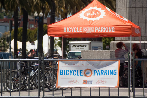
SF Farmer's Market Bike Valet
8a-2p Harry Bridges Plaza
Ferry Building Marketplace
One Ferry Building
San Francisco, California 94111
For more info:
http://www.ferrybuildingmarketplace.com/bike_valet_parking.php
http://www.sfbike.org/?chain
Kamis, 14 April 2011
Divisadero and the walk

I have often wondered what the name Divisadero means. I Googled it and found an article in the Post and Courier about a book by the same name. This article says, "'Divisadero,' has two meanings, both pertinent to the plot shift. The first comes from the Spanish word for 'division.' The second derives from divisar, meaning 'to gaze from a distance.'"
Now, I know that this comes from a book review and that I didn't really take the time to search further for any meaning here but this is likely the best set of definitions. Starting in the Marina District in the north of The City and ending in the Castro where it connects with Castro Street, Divisadero the street offers a great of example of both definitions. However, after looking at these definitions I wondered about the prescience of early city planners who annexed the "Western Addition" in the first place.
Encompassing the opulence of Pacific Heights, the rustic beauty of Alamo Square and the often times seedy run down qualities of many things in between, "The Addition" as I like to call it, was really envisioned as a way to solve many of the cities growth problems. The act offered residents a way out of the inner city, which we have come to see as downtown. Looking at it this way makes one realize that Divisadero was not so much derivative of the concept of "division" as much as it does "divisar" judging from the wide variety of views available from its highest points Near the Presidio and Buena Vista park.
Today Divisadero really has become The City's great divider though since crossing it in an easternly direction at Lombard, Geary, Haight and Market streets indicates that you have left the broadly residential areas of San Francisco and have entered its more commercial heart.
Divisadero Art Walk
Thursday April 14th 2011
5-10pm
Haight to Geary Street
Hope to see you this afternoon to evening out there!!
Rabu, 13 April 2011
Grace Cathedral
I met my mother at the Westfield Mall today. We went to some shops in the Union Quare area and then walked up to the top of Powell. I have been making a point to help out with mom lately because Grandma has been recuperating at the Hospital. That is where we went together today. The first image is the view from Grandma's room. We call her "Nana".

Before hand we stopped at Grace Cathedral and mom and I walked the labyrinth. The second image is mom walking it. It is supposed to be contempaltive.
Before hand we stopped at Grace Cathedral and mom and I walked the labyrinth. The second image is mom walking it. It is supposed to be contempaltive.
Minggu, 10 April 2011
Sunday Streets Sunset!!
I visited Golden Gate park today and got to participate in Sunday Streets. Always a fun experience. As usual the panhandle to crossover was closed in the morning for Sunday, so as I headed out to the beach from my usual early cup of joe at Mojo on Divisadero I didn't notice anything much different. The traffic light at Masonic had a small crowd, the bicyclists at Stanyan STILL had no idea how to get into the park.
I headed in to the Park and then discovered that, yes, there was a difference. More people on Sunday for certain. I suppose the sun had come out or maybe the wind had died down. Mile for mile I saw more children more couples more rollerskaters. There were roller skate racks at the roller drome on 5th and many more swing dancers out.
I got to the PCH overpass and took a few fotos:
I had a great time.
The park at times can be an unaccomodating place at Crossover Drive but today as you can see the ride through it was a breeze!


I headed in to the Park and then discovered that, yes, there was a difference. More people on Sunday for certain. I suppose the sun had come out or maybe the wind had died down. Mile for mile I saw more children more couples more rollerskaters. There were roller skate racks at the roller drome on 5th and many more swing dancers out.
I got to the PCH overpass and took a few fotos:
 |
| From SundaySts1 |
I had a great time.
The park at times can be an unaccomodating place at Crossover Drive but today as you can see the ride through it was a breeze!


Langganan:
Postingan (Atom)